Measuring Soil Erosion
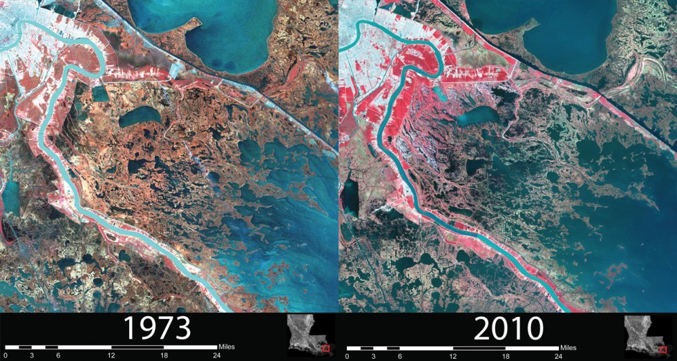
Due to climate change and other factors, there has been a large amount of soil erosion in the gulf coast. In order to measure how much soil erosion has happened, and to predict future soil erosion, researchers look at satellite images.
Satellite photo showing soil erosion in the gulf coast
In order to make specific measurements of the amount of soil erosion, we have programs that look at those photos and figure out which pixels are land and which are water.
Click the button to show how a satellite photo becomes a grid.
You can hover over the image with your mouse to see how they overlap.
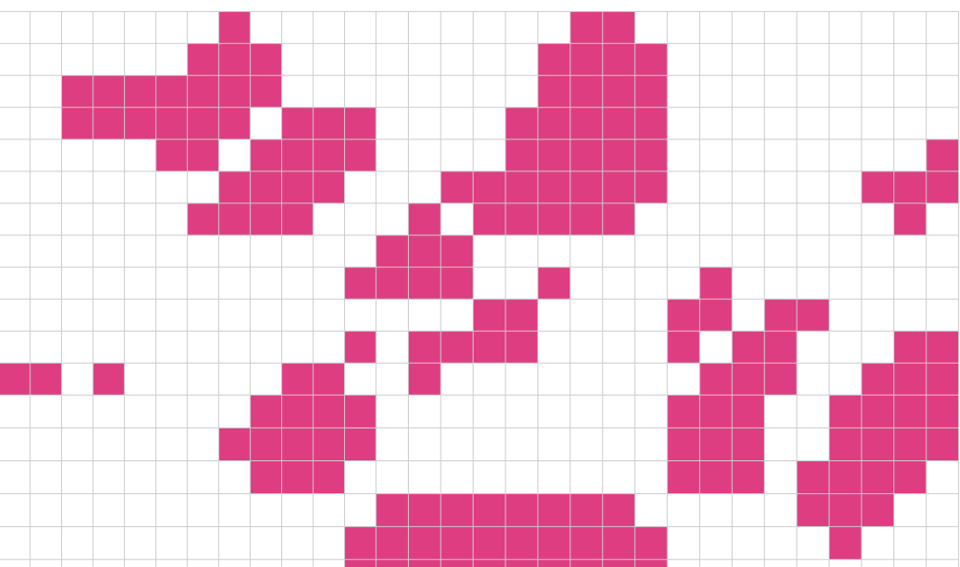
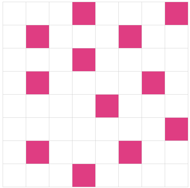
The satellite photo is converted into a grid, that only shows if a pixel is land or water. After these images have been converted to a simple grid, we do calculations on them to find out how "solid" each piece of land is. Solid means how much a piece of land is resistant to erosion. When you have several chunks of land right next to each other, they resist erosion better than if they were far apart.
A weak configuration. Likely to become eroded.
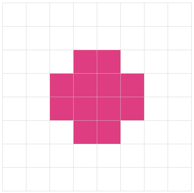
A strong configuration. Very resistant to erosion.
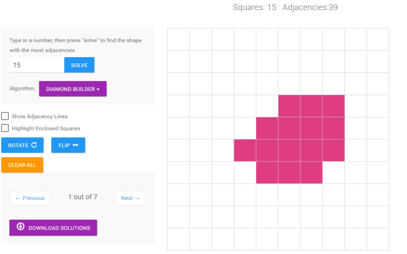
The way we measure how strong a piece of land is, by counting the number of "adjacencies" they form.
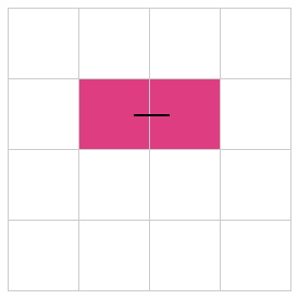
If two chunks of land are right next to each other they form an adjacency.
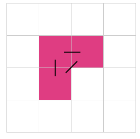
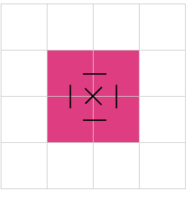
This piece of land has 3 adjacencies. Diagonal and vertical adjacencies also count.
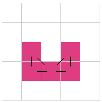
This piece of land has 6 adjacencies. It has 4 blocks of land, so we would consider it size 4.
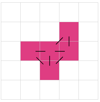
This piece of land has size 5, with 6 adjacencies.
This piece of land also has size 5, with 7 adjacencies.
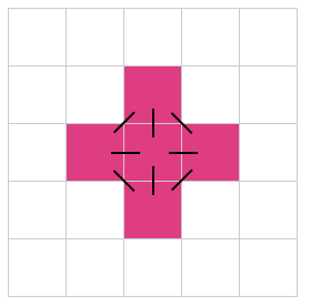
This piece of land also has size 5, with 8 adjacencies.
The thing to notice is that some configurations of land are better than others. If you have a certain amount of blocks of land, then you want to arrange them in the optimal configuration that will produce the most adjacencies.
This brings us to the main purpose of this site, finding optimal shapes for particular sizes of land. What this means is that, for any number of blocks of land, we want to find the shape with that amount of blocks that produces the most amount of adjacencies.
Below, you will find an interactive tool that will determine the best shape for a particular size. Type in a number, and press "solve" and it will find the shape of that size with the most adjacencies.